In WED, you can click on the menu bar for View and select one of the following from the Slippy Map menu:
OpenStreetMap - which displays the line drawn map that is used by X-Plane to add roads and other basic scenery details.
ESRI Imagery - Which shows the satalite photographic images for the scenery on display.
The following image shows Santo Pekoa Airport , Vanuatu, in the default scenery in X-Plane 11 with my basic ruler in the frame. I use this and a series of other tools to map out the scenery dimensions before attempting to design buildings dimensions and details for scenery design.
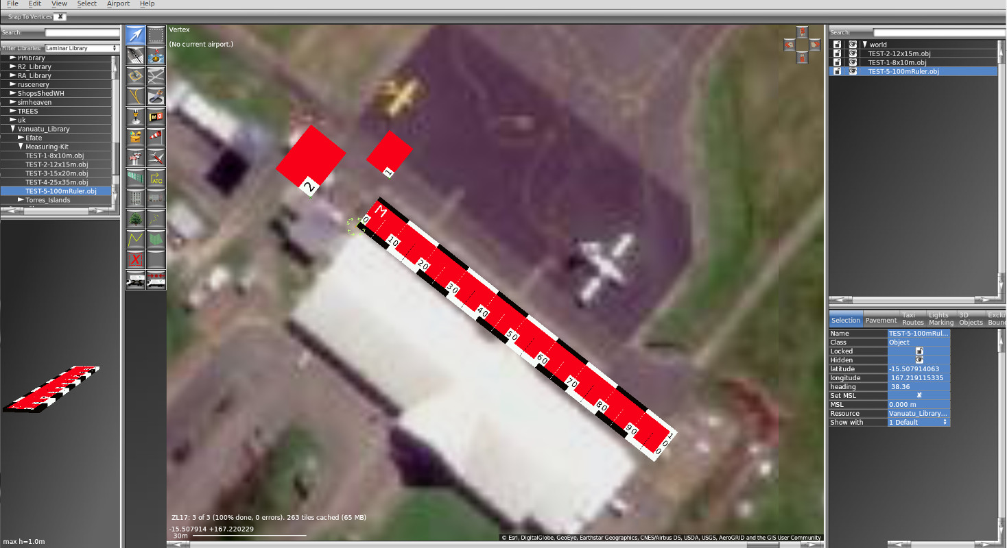
The ruler is a 1m high block, marked out in 10m bars and 5m marks over a 100m length. It can be placed into the scenery and used to measure buildings and objects. For 200m, two copies of the ruler can be placed end to end.
Download the ruler to your download folder and place in custom scenery. Help Tools.zip
Other tools can be made using a CAD program to add to your WED toolbox. Shown here are two boxes of known size for assessing the dimensions of buildings from the ESRI image.
Top
Tips
A Boeing 747-400 has a wingspan of 64m. By placing the planes wing tip to wing tip across a scenery, the dimensions can be estimated relative to this aircrafts wingspan.
A bit of tool creation or imagination can save time in the long run by providing information more easily.
.