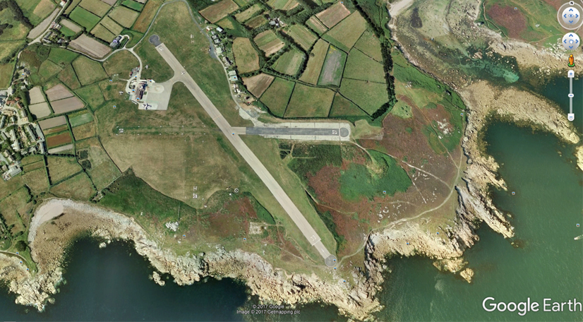
Placing a runway for an airfield update (or addition) required a bit of judgement, so some research is appropriate first. Check the position on google earth and compare it with the X-Plane scenery. I shall use St Mary's Airport in the Scilly Isles, UK as an example.
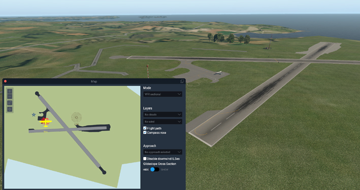
Option 1. Open the default airport in WED and edit it.
Import from Gateway Scilly Isles St Marys, choose the recommended file and open.
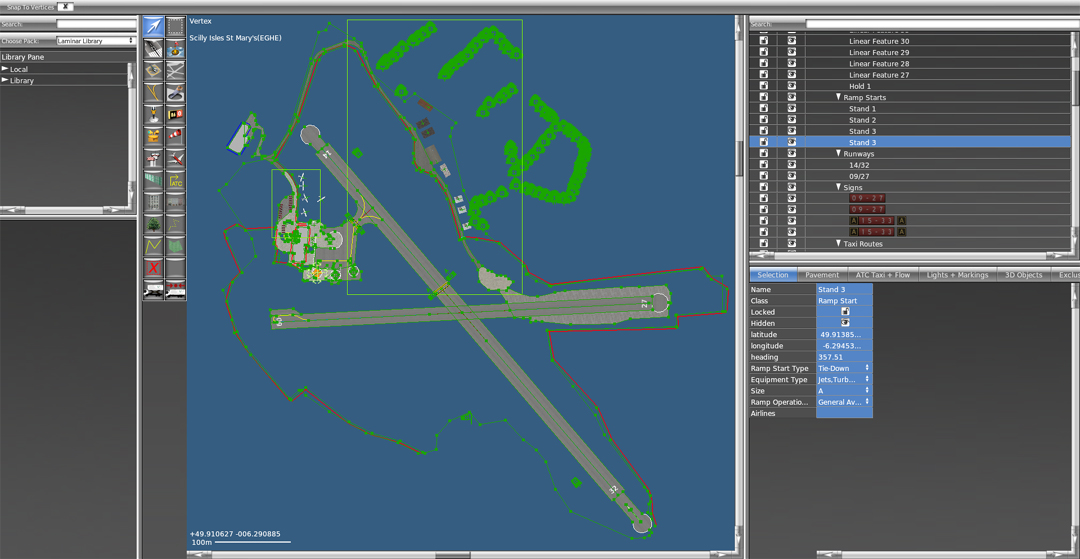
Save the file to your own folder and export to X-Plane to put this airport scenery onto your sim.
You can now check the scenery and start editing it to fit your needs.
Overlay the runways with the surfaces you want (Grass, Tarmac, Concrete) - Then set the runways to transparent. You can play with the editor to adjust the finish.
You can open X-Plane 11 and WED together and toggle between them. if you alter WED, then save and export scenery pack, you can toggle to X-Plane and - using the developer tag, reload scenery - to see how the changes have worked.
Option 2.
Placing the runway over the existing airport, or onto open
scenery.
Go to Great Circle Mapper and check the Geographical and runway information.
St Marys Airport, Scilly Isles UK
Lat/Long 49.913333 -6.291666
Main Runway 15/33 600m x 23m paved, 84m MSL
Place
a tall antenna onto the blank WED sceen display
(Library/CDB-Library/antenas/antena24m.obj). Alter
the
Latitude and Longitude to match that of the airport. Zoom out
to
locate the antenna, then zoom in to it.
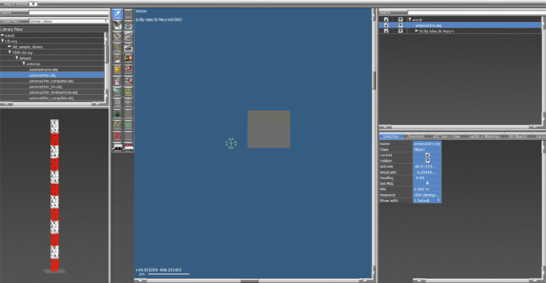
This is usually the location of the runway mid-point, or the terminus.
Add the main runway and set the length width and texture -
with the runway mid point on the antenna.
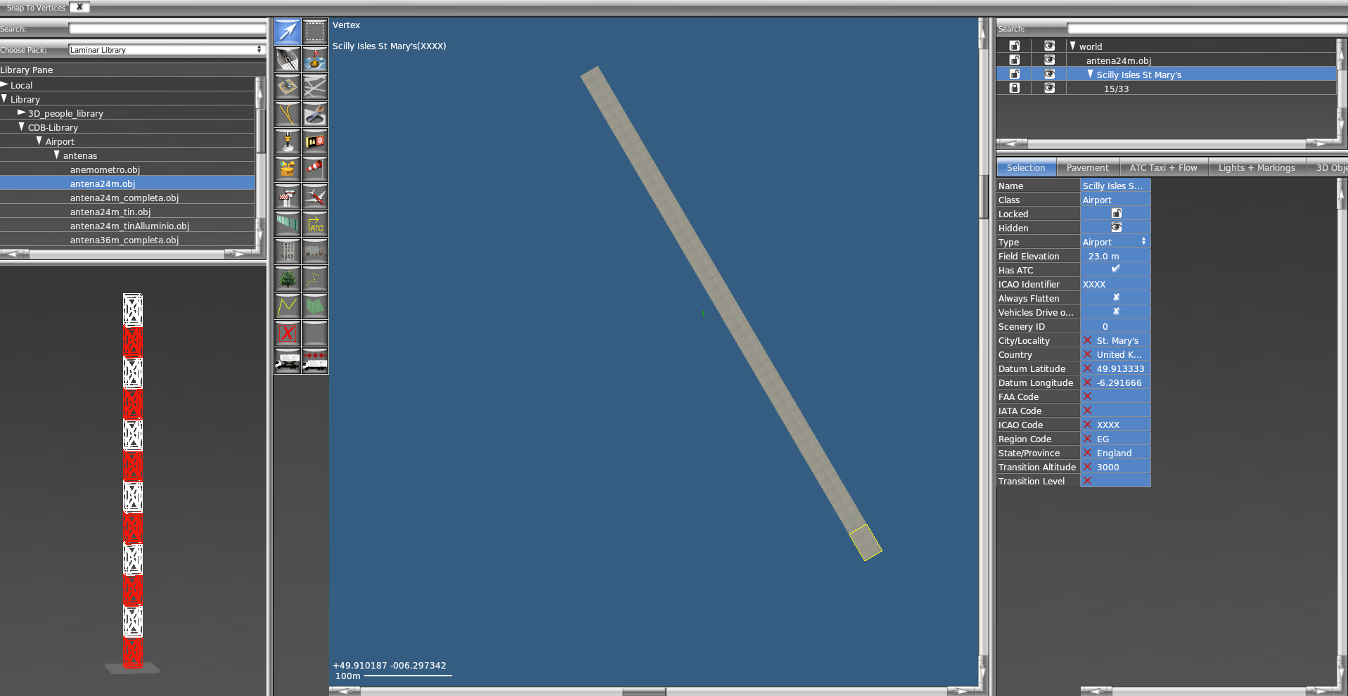
The airport ICAO codes should be set to XXXX in two place before saving the airport. This will enable the runway to be placed over the existing scenery for comparison. The antenna and the concrete runway will stand out clearly on top of the existing runway. If you set the two ICAO codes to EGHE, your runway will replace the default scenery.
Save the file to your own folder and export to X-Plane to put this airport scenery onto your sim.
With WED still open, load up X-Plane and select your runway (Scilly Isles St Mary XXXX).
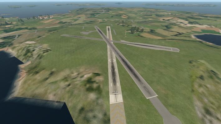
In this case (Sep 2017), the runway details listed on www.gcmap.com are 10 degrees out of alignment to the current scenery runway. The Long/Lat position is on the centre of the runway, as expected. Compared with the Google Earth image, the current runway position looks more accurate that the new runway position. Descision time!
Check the runway alignment from at least 3 other sources before altering the position.
With WED 2.2 and later, you can select the view for Slippy Maps and load OSM or ESRI images as the working background. That enables you to place runways and aprons more accurately without plotting points geographically.
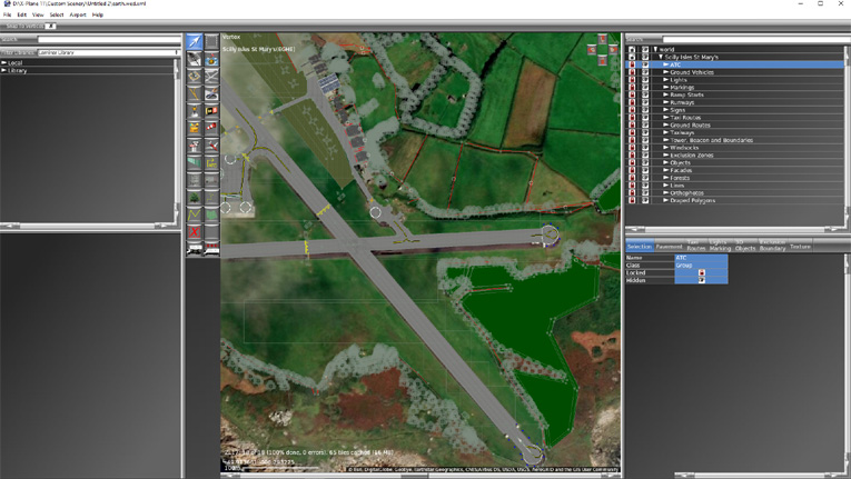
In this example (May 2020) the Gateway default runway for Scilly Isles St Marys is just a tad out of place with the ESRI data. A very good fit by any standard.
Useful Links
ww1.jeppesen.com - airport-signs.pdf
.