X-Plane 11, and previous editions, obtain their default scenery from a number of sources. This sets up a terrain that is fixed within the flight simulator. Any alterations can be made by excluding some scenery items and adding your own version to replace them.
OSM (Open Street Map) is a user adapted map that can be edited under moderation to produce an accurate version of ground features. This is used by X-Plane to add the default features of the scenery. Things that are added in this way include the following;
Roads; Railways; Power lines; Water features; Building height information; Land use data (Industry, mining, glacias, etc.).
OSM information cannot be edited in WED. Some items can be excluded or group excluded using an exclusion zone. Texture polygons can also be laid over the default ground texture to change the effect.
Landclass This is information stored in the flight simulator files to define the groundmesh cover. Sea is created where there is no land, and the land cover is generated across the triangles of the groundmesh to colour the terrain with an approprtate predetermined texture. This marks out the terrain type and the tree cover. This gives a good approximation of the ground across the planet.
Issues with placement.
The terrain in X-Plane 11 is generally very good and the roads are generally accuraterly placed. The coastline form is simplifedand usually in the right place.
Scenery accuracy is excellent for the USA, most of Europe and much of Australia and New Zealand.
The accuracy is less convincing in parts of Africa, small oceanic islands and small and out of the way places.
In general - if there is a nearby beacon or navigation aid to the scenery you are working on, take that as accurately positioned (even if it is out of place by a bit - 500 meters is not significant at this level) If the internal navigation system works, pilots will find the airfield relative to the system.
There are some islands in the open oceans that are anything up to 2 Km out of place, but have beacons positioned correctly relative to their position in the sym terrain. It is easier to go with the beacon position than to worry about moving the islands.
One example of this issue is the Pacific Island of Rabi, in Fiji.
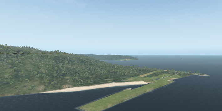
The default airport has been placed at its exact geographical location, but the island terrain is positioned 1000m out of place. This leaves a land based airport in the sea. This error cannot be edited out of the terrain date easily and needs to be entered as a bug report. The fault will be corrected in due course.
https://www.openstreetmap.org/