Fiji Western Division Map
Fiji - Read Me File Fiji Home Page
Northern Division Airports Central and Eastern Division Airports Fiji Islands Map
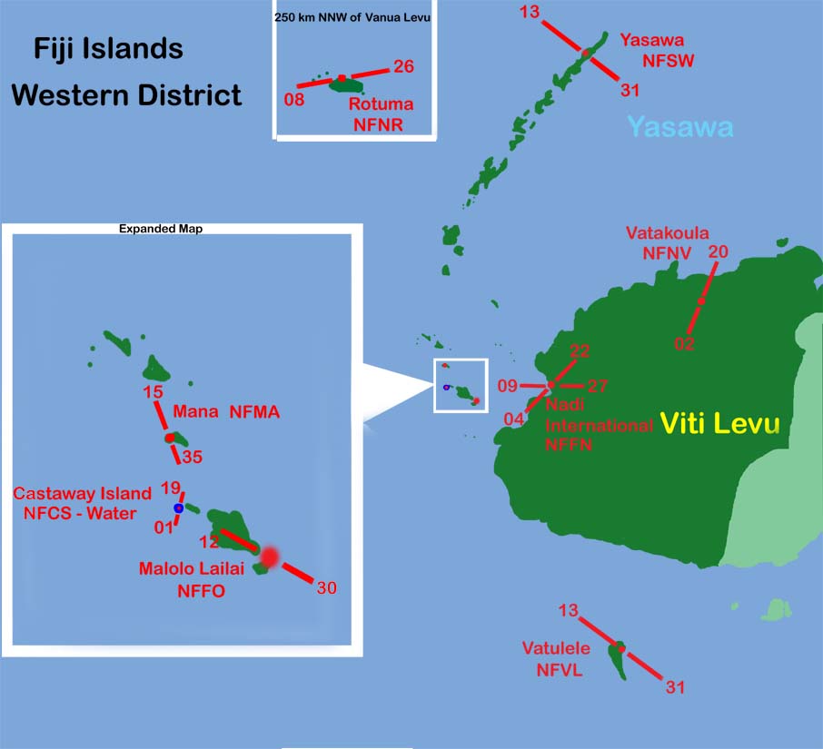
Within the Wester Division is Nadi International Airport. This is a main refuelind stop for international airline traffic. The other airfields in this Division are local airstrips or tourist holiday destinations. Most of the local flights originate at Nadi International.
Nadi International Airport: NDA (H) 112.50 MHz
NDB (H) 405.0 kHz (Navakai) VK ...- / -.- NDB (H) 364.0 kHz (Momi) NI -- / ..
VOR/DME High Alt. 112.50 MHz NN -. / -.
ILS 02 (INN) 109.900 Heading 024 3208 ft runway 59 ft AMSL
ATIS: 127.900 MHz, Ground: 121.900 MHz, Tower: 118.100 MHz, Approach: 119.100 Mhz.
Rotuma: NDB (H) 277.0 kHz RM .-. / --